|
By: Paul S Cilwa |
Posted: 4/17/2010 |
|
Page Views: 1,771 |
| Hashtags: #Tonopah #Arizona #SaddleMountain #Photography |
| I go 4-wheeling in the Sonoran Desert. |
| Estimated reading time: 5 minute(s) (1131 words) |
I spent last night at El Dorado Hot Spring in Tonopah, but this
time didn't bother bringing a tent—I simply inflated a queen-sized
mattress in the back of the SUV and made it into a bed; then tossed
a bag with toiletries and clean clothes into the passenger seat, and
set out on my way.
You can see Saddle Mountain from the hot spring. A number of the
soaking areas, in fact, are positioned so as to frame it as one
soaks.
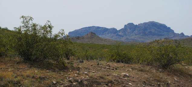
I had been to Saddle Mountain once before, shortly after Michael and
I joined ANDES, the Arizona Nude Dudes (a gay men's nudist club). I
went on a nude hike out here, the last one I ever expect to make in
Arizona. While I love the feel of the sun on my whole body, Arizona
does not really provide a nude-friendly environment. It's too
prickly. Everything has sharp edges and most things have spines. It
took three weeks for the scratches on my butt to heal.
So this time I kept my clothes on and concentrated on driving my
trusty Ford Expedition as close as I could to the mountain itself.
What's The Deal
Saddle Mountain, despite its proximity to I-10, provides a
solitude experience that's hard to come by even in the more remote
parts of the state. I did see one other car while I was there, but
only one. And I heard nothing: No power lines, no rock music, no
shotguns. When I shut down my engine, other than the brittle desert
breeze and my own breathing, there were no sounds at all. I would
generally recommend the place for its many hikes and secluded side
canyons. But it's terrific for a Saturday drive as well.
How To Get There
Exit 94 off I-10 is the Tonopah exit, and puts you right on 411th
Avenue. Take it south a couple of miles till it forks, and turn
right onto Salome Highway. The scenery from Salome is exquisite in
its own right; and yet almost everything you see acts to draw
attention to Saddle Mountain, which rises up from the desert floor.
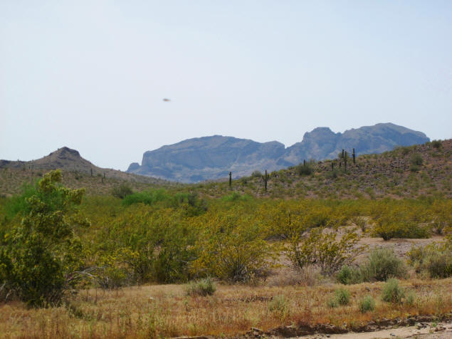
Another 3 miles or so will get you to the end of the pavement, but a
left onto West Courthouse Road is still paved. Continue south until
you see the Saddle Mountain trail info kiosk; it's just off the road
but visible from it. Or, use your GPS set to these coordinates:
Latitude: 113° 3' 30.576" S Longitude: 33° 27' 8.59" E
The Drive
Don't attempt this without a high-rise, 4-wheel drive vehicle!
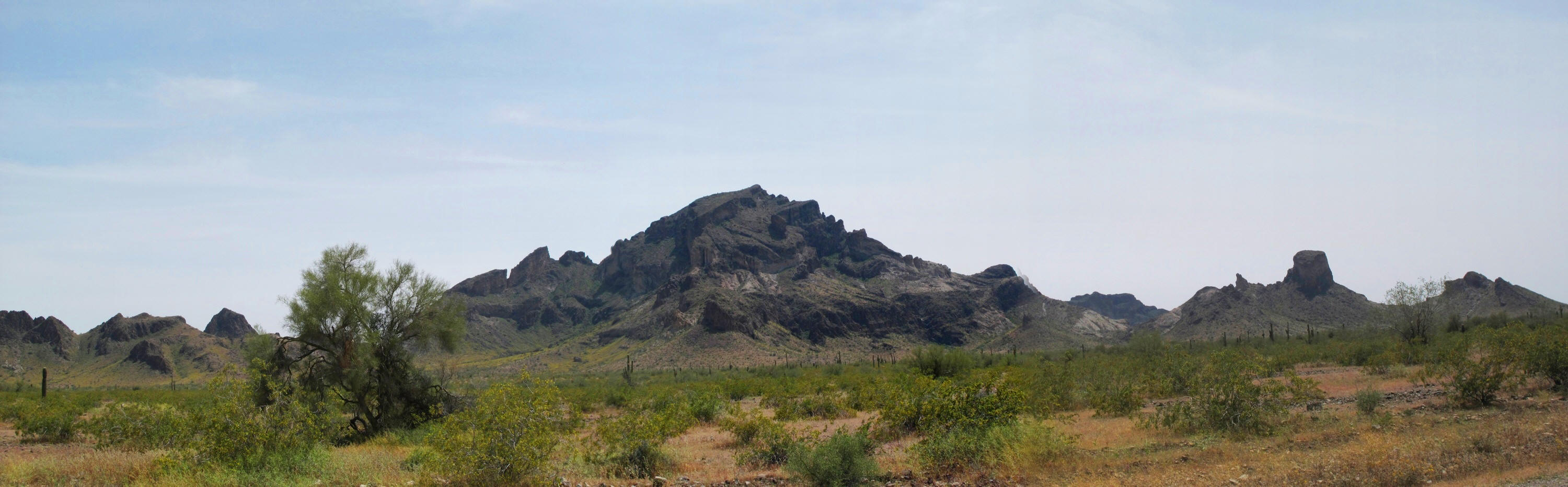
I first drove south of the kiosk, staying on Salome Highway, to a
point where I could get a panorama of this chunk of ancient volcano.
From another, slightly closer vantage, Saddle Mountain rose above an agricultural field.
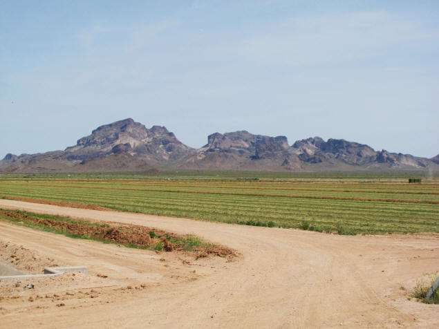
I then turned onto the dirt road leading directly to the kiosk and the mountain.
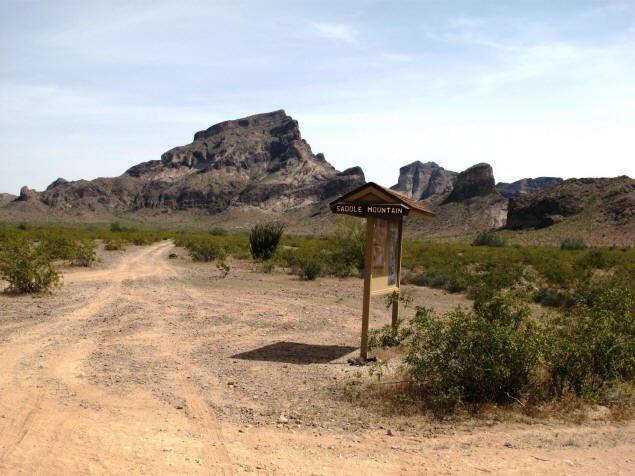
The road splits at the kiosk. I took the right-hand road.
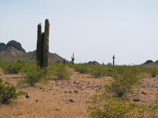
Stately saguaros, Arizona's state tree, stand guard along the
desert floor. The yare fairly limited as to the altitude at which
they can grow, and do not go high up the mountainside. It being
springtime, there were also a multitude of wildflowers.
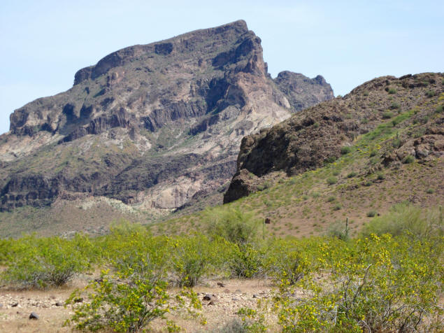
The kiosk is on the western side of the mountain but the road I took
curved around to the south, then headed back towards the eastern
side. The mountain is so irregularly shaped that it takes on a
completely different appearance from every angle.
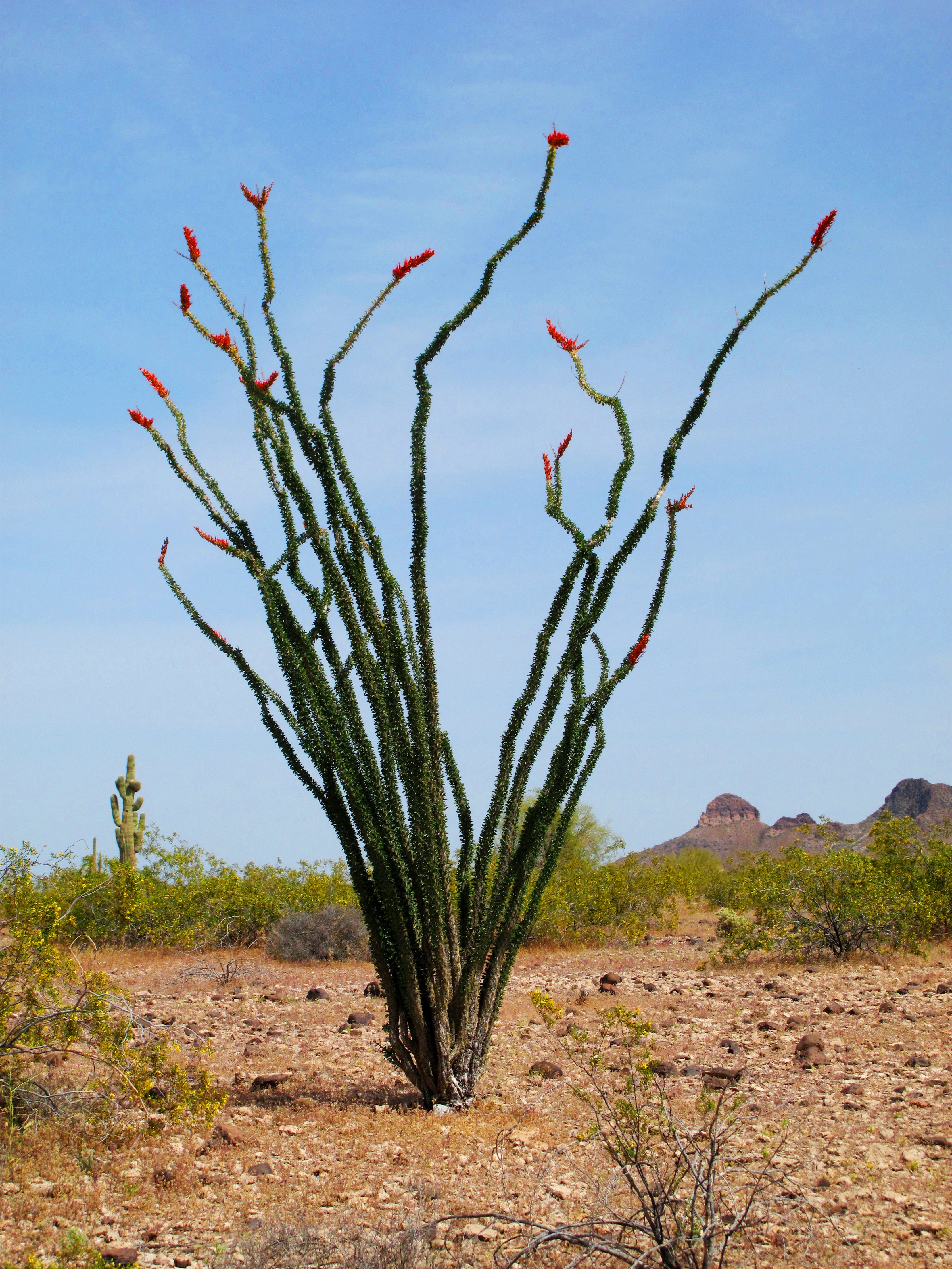
As I mentioned, the desert was definitely blooming. For some
reason, I've never noticed an ocotillo bloom before; but these were,
their spiny fingers red as if they'd just had their nails done.
Ocotillo spends much of the year looking like a dead bush. Only
on close examination can one see the traces of green present in its
prickly stems. But when it rains (and we had a wet winter this
year), the stems grow tiny leaves, giving them a green appearance.
And, as I saw, the ocotillo blooms at the tips are orange-red, and
attract bees and hummingbirds of various sorts.
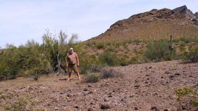
Even though I was alone I wanted "proof" I'd been here. So I
struggled with the timer on my camera, which I have not yet
mastered, perched it on the side mirror of the car, and ran into the
desert as quickly as I could so I could turn around and pose before
the ten seconds ran out.
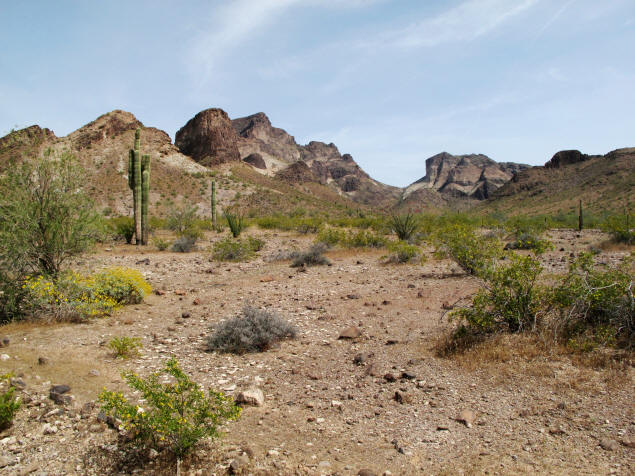
The below photo is probably the best I got of the actual "saddle"
that gives Saddle Mountain its name.
The Quaternary Period spans both the Pleistocene and Holocene
epochs. (We are in the Holocene epoch now.) Some 10 million years
ago Arizona was a hotbed of geologic activity, including many
erupting volcanoes stretching from what is now Flagstaff southward.
Saddle Mountain is twin cinder cones of a couple of these volcanoes.
The ground today is still littered with volcanic chucks spewed out
during one eruption or another.
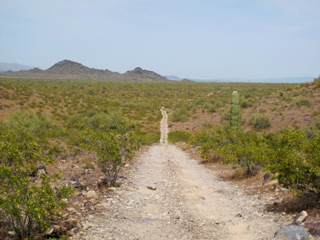
Just so you'll know what to expect, here's a typical stretch of
the road I followed. I did not attempt to exceed about 8 miles an
hour.
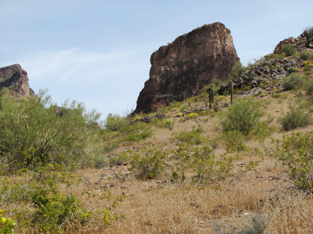
One of the cinder cones is still quite distinct and almost intact
after all these years.
Here's a clear picture of a cinder field. Imagine running through
here 10 millions years ago, trying to dodge the flying rocks!
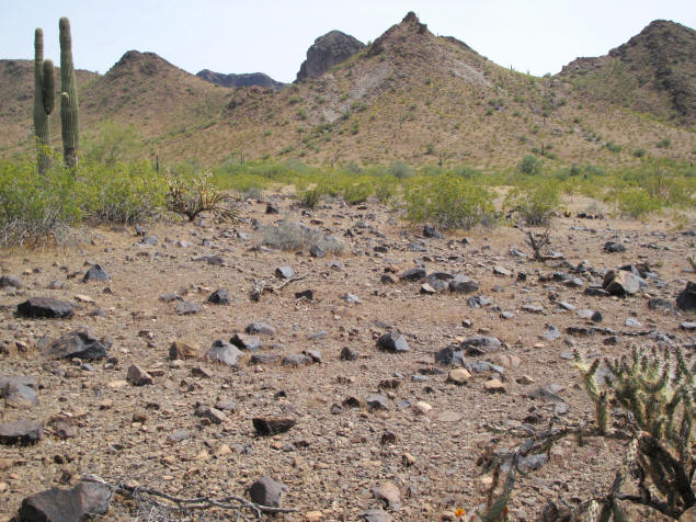
Not everything did, and there are more than a few fossils to be
found in these fields. From more recent times are many petroglyphs
left by local Native Americans, for whom Saddle Mountain was a
useful and unique landmark.
In the other direction, downslope, can be seen some of the
currently-farmed fields, with more volcanic mountains receding into
the distance.
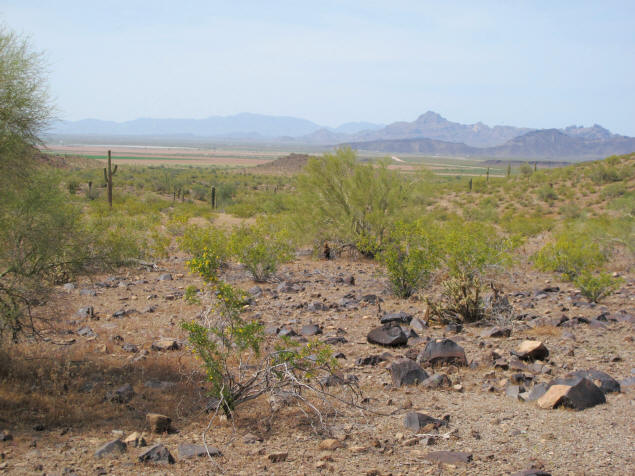
I suspect the dirt road that I took, to the right of the kiosk,
circles the mountain and returns to its left. But I don't know,
because I came to a major washout I didn't want to risk without
backup.
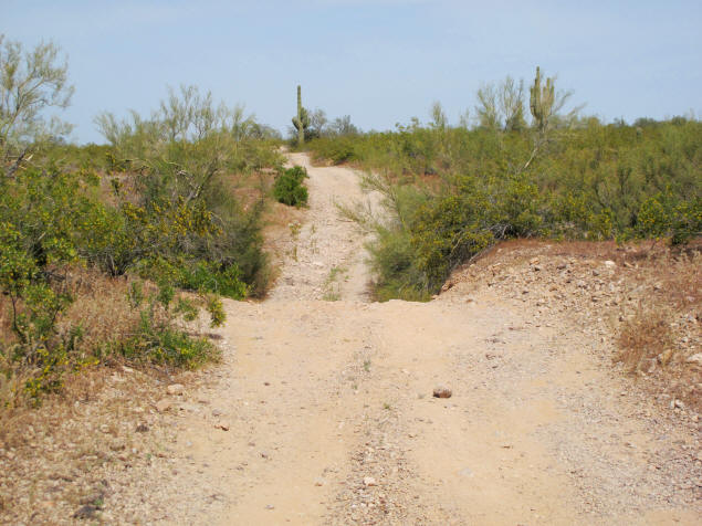
Besides, it was now getting time for dinner. So I turned around,
carefully onto a dry patch so as not to injure any more of the
desert than I could avoid, and returned the way I came. Within 30
minutes I was back in a tub, soaking in the lithium-rich mineral
waters of the hot spring!